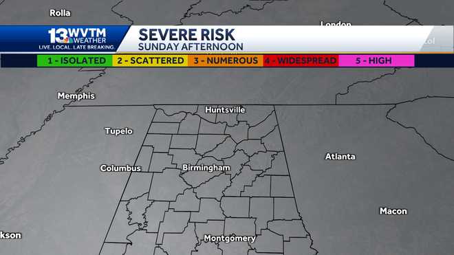
RIGHT NOW IS APPROACHING 545 IN THE MORNING. SO GETTING OUT THE DOOR THIS MORNING, IF YOU HAVE TO BE OUTSIDE ALL DAY LONG, THE STORM THREAT WILL INCREASE WITH TIME AND IT MAINLY HEADING INTO SUNSET. TEMPERATURES GET CLOSE TO ABOUT 70 DEGREES BEFORE THE IMPACTS BEGIN AND THEN YOU NEED TO BE ON ALERT. 7 P.M. AND MAINLY INTO AREAS OF 65. ALERT DAY MEANS THAT LIFE THREATENING WEATHER IS POSSIBLE THE TIMEFRAME IF WE’RE GOING FROM WEST TO EAST FOR PM IT STARTS OUR ALABAMA AND MISSISSIPPI BORDER COUNTIES AND THEN IT CONTINUES ON EASTWARD THROUGH 6 A.M.. BUT THE FLOOD THREAT, THE FLASH FLOODING THAT COMES AFTER, THE POTENTIAL FOR WIND, HAIL AND ISOLATED TORNADOES. THE STORM PREDICTION CENTER REALLY COLORATION ON THE MAP IS JUST PREDICTING WHERE THERE WILL BE SCATTERED TO POTENTIALLY NUMEROUS AND CERTAINLY WIDESPREAD THREATS FOR TORNADOES TODAY AND HOW IT BREAKS DOWN IN THE TIMELINE HERE IN CENTRAL ALABAMA, IT LOOKS TO BE 4 P.M.. THERE’S THAT BORDER MARION WINSTON AND WALKER COUNTIES IT STARTS UP HERE 7 P.M.. THAT CLUSTER OF COURSE WILL CONTINUE TO CHANGE IN APPEARANCE. SO WE’LL BE DISSECTING ALL OF THE THUNDERSTORMS TO SEE IF THERE’S ANY KIND OF BOWING IN THE NATURE OF THE RADAR SIGNATURE. NOW. 7 P.M. THROUGH 6 A.M. THIS IS WHERE THE FLOOD THREAT WILL START. AND I THINK THAT’S MAINLY FOR A LOT OF THE TRIBUTARIES OF THE COOSA. SO WATCH OUT AROUND PELL CITY RIVER SIDE AND MOVING INTO LAKESIDE LANDING. SO THE RAIN SHOWERS ARE ALREADY BEGINNING TO LIFT UP AROUND LOUISIANA AND SOUTHERN ARKANSAS. SO WE’LL CONTINUE TO WATCH THE SATELLITE RADAR COMPOSITE TO SEE HOW IMPACTS WILL CERTAINLY START TO TRICKLE IN TODAY. THE BE ON ALERT FOR SEVERE WEATHER STARTING AT 4 P.M., BUT WHEN’S A DAY? MORNING. KEEP IN MIND THERE COULD BE SOME RESIDUAL RAIN THAT IS LEFT BEHIND A.K.A THE FLOOD THREAT. THIS IS 3 P.M. TODAY SO YOU SHOULD BE ALRIGHT IF YOU ARE IN CARPOOL THIS MORNING. CERTAINLY YOU’RE FINE. YOU’LL START TO SEE THE COVERAGE INCREASING BY 6:00 IN THE AFTERNOON. CERTAINLY IN ALABAMA. BUT I 65 INTO DINNER TIME, THE COVERAGE BECOMES A LOT MORE WIDESPREAD AND I THINK IT STARTS TO BECOME A LOT MORE OF A CLUSTER OF RAIN THAT TAKES ABOUT 2 TO 3 HOURS TO MOVE SOUTH WHERE THIS IS MIDNIGHT TO ABOUT FIVE, 6:00 IN THE MORNING. WE’RE TALKING ABOUT SOME RAINFALL ON THE ORDER OF 1 TO 3 INCHES PER HOUR. SO THIS AFTERNOON, JUST BE VERY MINDFUL DURING THE LUNCH HOUR, YOU’LL SEE TEMPERATURES IN THE LOW SEVENTIES, THE IMPACTS FROM THE RAIN WILL START AND THEN WE HAVE TO BE ON ALERT BEFORE YOU HEAD TO BED TONIGHT, DOWNLOAD OUR FREE WVTM 13 APP AND. SET THOSE ALERTS IN CASE THERE’S A WATER WARNING IN YOUR AREA, YOU’LL BE NOTIFIED. ONLY MORNING STORMS
Alert Day: 70s and Dry Tuesday turns stormy before sunset in Central Alabama
ALERT DAY on Tuesday: the day starts chilly and dry, but that stormy feel returns by afternoon. Some heavy rain and severe storms move in late Tuesday through Wednesday morning. Check the video forecast for the latest.TUESDAY NIGHT/WEDNESDAY MORNING STORMSGet the free WVTM 13 app and turn on the alerts for severe weather information based on your geographic location.November often brings stormy weather as a ‘secondary’ tornado season in Alabama. A powerful storm system moving into the region Tuesday poses a threat of intense thunderstorms as well as some flash flooding Tuesday night into Wednesday morning: Rain: Showers develop by early afternoon, but the heaviest rain comes with stronger storms after 4 PM Tuesday through 6 AM Wednesday. Localized flash flooding is possible where multiple slow-moving storms pass over the same areas. Most of North and Central Alabama gets around an inch of rain; up to 5” of rain may fall in a few, isolated areas.Thunderstorms: Severe thunderstorms with strong winds, hail and tornadoes are possible late Tuesday evening through early Wednesday morning (from around 4 PM at the earliest in West Alabama to around 6 AM in East Alabama). Wind: The day begins with a quiet, cool morning, but the breeze increases throughout the day. Occasional gusts over 20 MPH are possible before sunset and over 30 MPH between 4 PM and 6 AM.SEVEN DAY FORECASTRain and storms move out of Central Alabama by sunrise Wednesday leaving us dry with a cool northwest wind and temperatures around 55-60°F through the afternoon.Thursday looks dry and chilly: a little more like late December with morning lows around 28-33°F and daytime highs in the low-50s with some sunshine.Another disturbance passing through on Friday spreads clouds over Alabama, and more showers develop over the weekend. Several waves of wet weather appear likely from Sunday through early next week ahead of another significant shot of cold weather around December 7th-10th.—STAY WEATHER AWAREGet the free WVTM 13 app and turn on the alerts for the latest weather updates.For the latest Birmingham weather information and central Alabama’s certified most accurate forecast, watch WVTM 13 News.Current Weather ConditionsHourly Forecast | 10-Day ForecastInteractive RadarBirmingham SkycamsLive Doppler RadarSign Up For Email Weather AlertsDownload the WVTM 13 AppDon’t forget to follow us on Facebook, Twitter and Instagram.
ALERT DAY on Tuesday: the day starts chilly and dry, but that stormy feel returns by afternoon. Some heavy rain and severe storms move in late Tuesday through Wednesday morning. Check the video forecast for the latest.
TUESDAY NIGHT/WEDNESDAY MORNING STORMS
Get the free WVTM 13 app and turn on the alerts for severe weather information based on your geographic location.
November often brings stormy weather as a ‘secondary’ tornado season in Alabama. A powerful storm system moving into the region Tuesday poses a threat of intense thunderstorms as well as some flash flooding Tuesday night into Wednesday morning:
- Rain: Showers develop by early afternoon, but the heaviest rain comes with stronger storms after 4 PM Tuesday through 6 AM Wednesday. Localized flash flooding is possible where multiple slow-moving storms pass over the same areas. Most of North and Central Alabama gets around an inch of rain; up to 5” of rain may fall in a few, isolated areas.
- Thunderstorms: Severe thunderstorms with strong winds, hail and tornadoes are possible late Tuesday evening through early Wednesday morning (from around 4 PM at the earliest in West Alabama to around 6 AM in East Alabama).
- Wind: The day begins with a quiet, cool morning, but the breeze increases throughout the day. Occasional gusts over 20 MPH are possible before sunset and over 30 MPH between 4 PM and 6 AM.
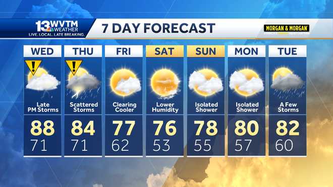
SEVEN DAY FORECAST
Rain and storms move out of Central Alabama by sunrise Wednesday leaving us dry with a cool northwest wind and temperatures around 55-60°F through the afternoon.
Thursday looks dry and chilly: a little more like late December with morning lows around 28-33°F and daytime highs in the low-50s with some sunshine.
Another disturbance passing through on Friday spreads clouds over Alabama, and more showers develop over the weekend. Several waves of wet weather appear likely from Sunday through early next week ahead of another significant shot of cold weather around December 7th-10th.
—
STAY WEATHER AWARE
Get the free WVTM 13 app and turn on the alerts for the latest weather updates.
For the latest Birmingham weather information and central Alabama’s certified most accurate forecast, watch WVTM 13 News.
Don’t forget to follow us on Facebook, Twitter and Instagram.
(Except for the headline, this story has not been edited by PostX News and is published from a syndicated feed.)


