
RADAR CHECK: Most of the rain across Alabama at mid-afternoon is over the far southern part of the state; showers are widely spaced over the northern counties. Temperatures are mostly in the mid to upper 80s; Mobile is in the upper 70s thanks to clouds and rain. We will maintain the chance of showers and a few thunderstorms tonight; the low will be close to 70 in most places.

Tomorrow will feature more clouds than sun with scattered to numerous showers and thunderstorms across Alabama. SPC has most of the state in a “marginal risk” (level 1/5) of severe thunderstorms; heavier storms tomorrow could produce strong wind gusts and some small hail.
A surface front is forecast by global models to creep southward Wednesday, reaching the far southern counties of the state Thursday morning. This will allow drier air to move into much of the state, initially arriving over the northern counties Wednesday. Best chance of rain on Wednesday will be over the southern half of the state.
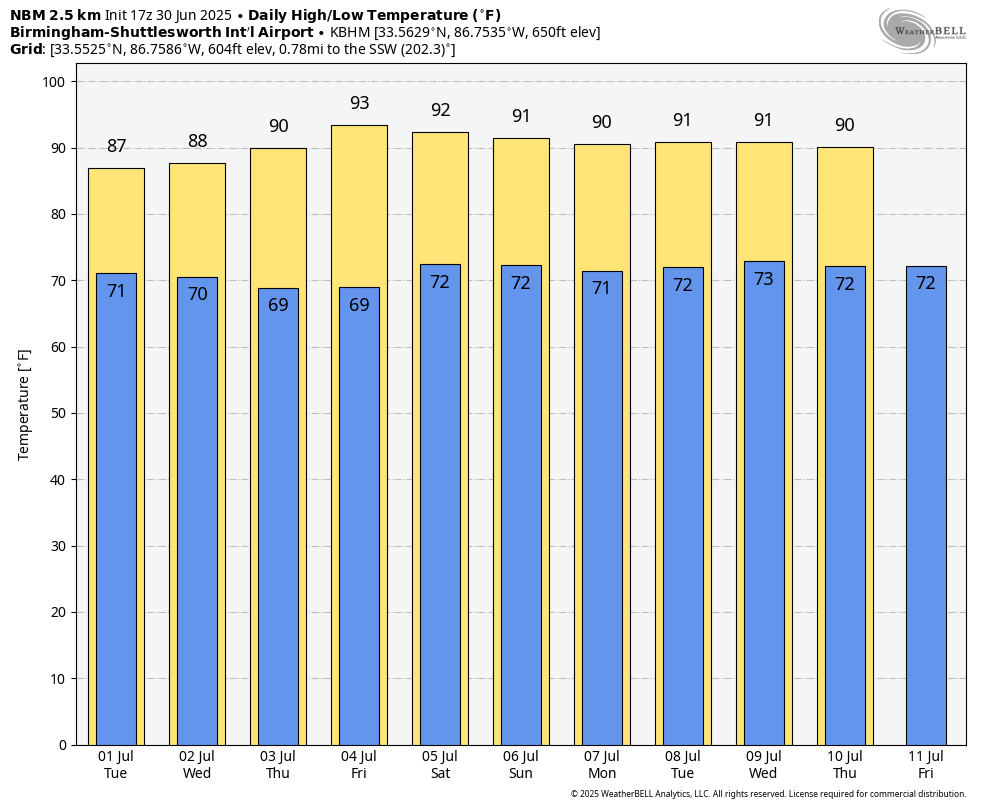
Showers will be few and far between statewide Thursday and Friday with lots of sun and slightly higher heat levels. Highs will be in the low 90s for most places, but humidity levels will be down. The chance of thunderstorms Thursday and Friday is not zero, but they should be very widely spaced, and mainly over the southern quarter of Alabama.
HOLIDAY WEEKEND: Moisture levels will slowly rise, so we will mention the typical chance of a pop up afternoon shower or storm Saturday and Sunday; chance of any one spot seeing rain will be around 20 percent Saturday, and 30-40 percent Sunday. With a partly sunny sky, afternoon highs will be in the low 90s, right at seasonal averages.
NEXT WEEK: We expect pretty standard summer weather for Alabama next week… partly sunny days with “scattered, mostly afternoon and evening showers and thunderstorms”. Highs will be in the low 90s for most communities… See the video briefing for maps, graphics, and more details.
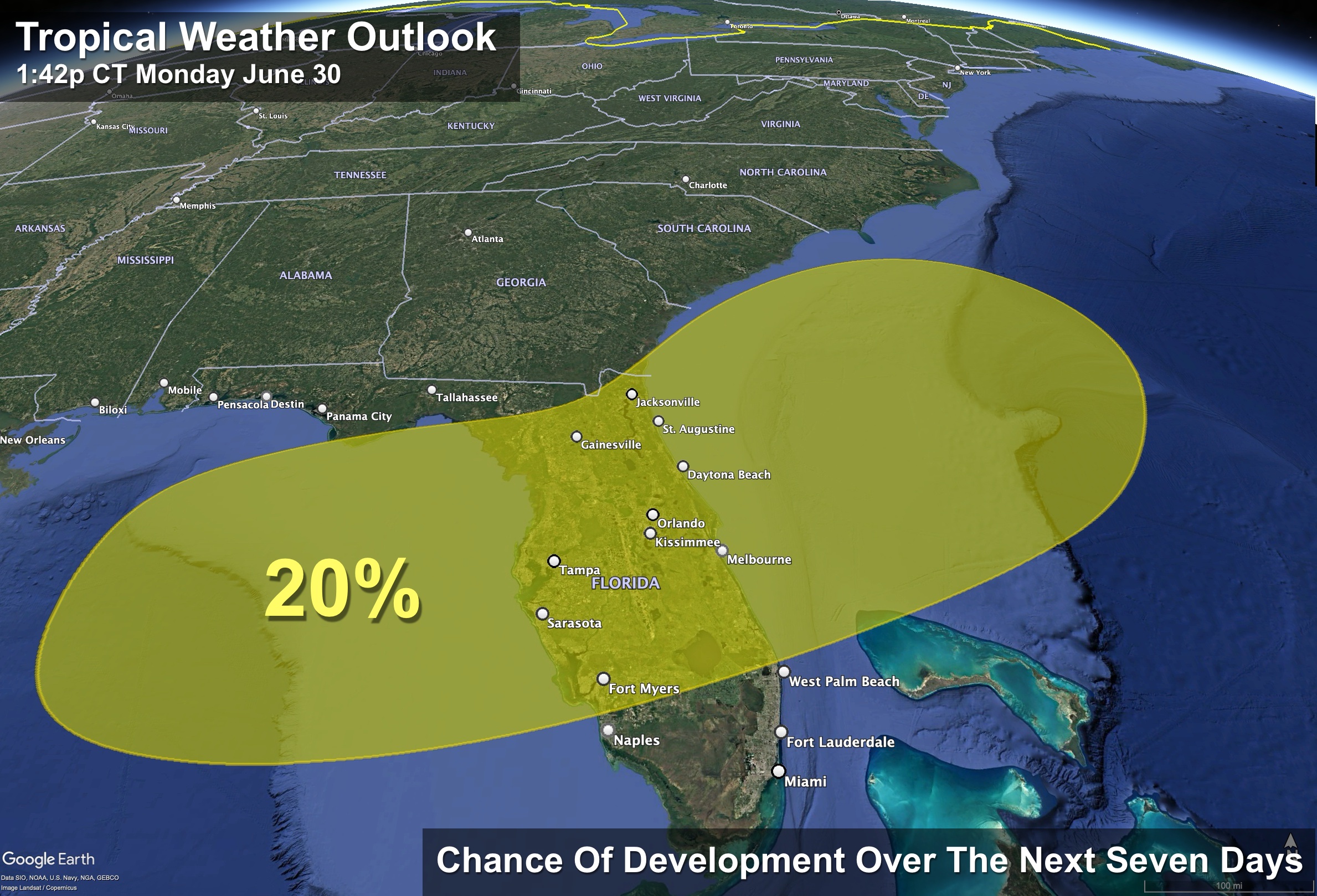
TROPICS: A frontal boundary is expected to stall and weaken off the southeast U.S. coast late this week. An area of low pressure could develop from the weakening front by the weekend off the southeast U.S., over Florida, or over the eastern Gulf. Some gradual tropical or subtropical development could occur thereafter as the low moves little. The chance of development in this region is only 20 percent for now; no need to cancel beach trips.
The rest of the Atlantic basin is very quiet.
ON THIS DATE IN 1912: An estimated F4 tornado ripped through Regina, Saskatchewan, Canada on this day. The storm became the deadliest tornado in Canada’s history as it killed 28 people along a rare, 18.5-mile track from south to north.
ON THIS DATE IN 2010: Hurricane Alex made its final landfall along the northern Mexican coast around 110 miles south of Brownsville, Texas as a Category 2 storm with maximum sustained winds of 105 mph. Alex was the first Hurricane in June for the Altantic Basin since 1995, and the strongest in the month of June since Hurricane Alma in 1966.
Look for the next video briefing here by 6:00 a.m. tomorrow…
Category: Alabama’s Weather, ALL POSTS, Weather Xtreme Videos
(Except for the headline, this story has not been edited by PostX News and is published from a syndicated feed.)