Happy Tuesday, July 1, 2025, South Florida!
Hopefully everyone had a nice start to the week as it will likely be the driest day of the week. A thin layer of Saharan dust lingered across the region to start the work week and that was probably one of the reasons the southeast coast of Florida stayed quiet through much of the day. As temperatures warmed, showers and storms developed in the afternoon but with a breeze off the water, all of that activity stayed west of our metro and kept us dry and steamy through much of the day. This morning was completely different as showers and storms surrounded South Florida.

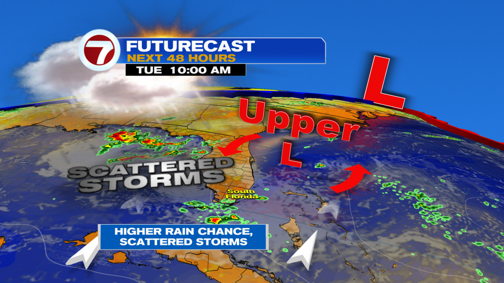
After a mostly dry start to the week, today’s forecast will feature scattered showers and thunderstorms. The reason? An upper level low that was over the Northwestern Bahamas on Monday is starting to drift towards the northwest. But as it still remains across the region, showers and storms will continue to develop across the area. With more of a south to southwest steering wind in place today, moisture will continue to be pushed in our direction. This is the moisture we need for storms. Because of the cloud cover and the showers and storms, our afternoon high temperatures will likely remain in the upper 80s.
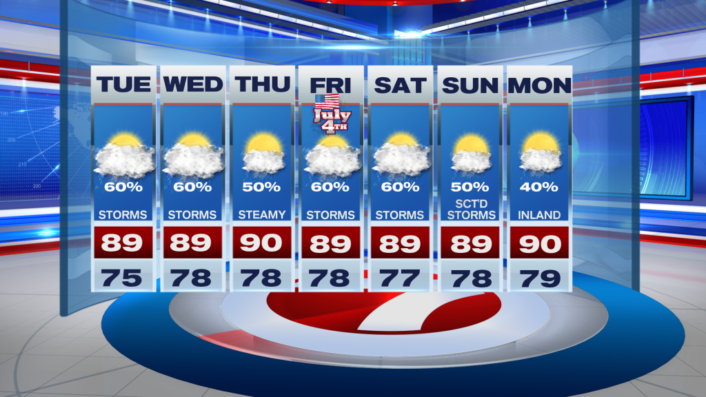
Looking ahead through the work week, South Florida will remain unsettled at times with scattered showers and thunderstorms (at times becoming numerous) on a daily basis. As we get closer to the Fourth of July holiday on Friday, our weather looks to remain unsettled. A front will be stalling near the Southeastern U.S. or across Northern Florida and an area of low pressure could spin up along that stalled front. The National Hurricane Center is watching this area closely as some development could be possible if and once a low develops along that front, especially if it develops over water. This would pose no immediate threat to South Florida, however, it means that the entire region will likely remain stormy through the holiday weekend. It will be something we will have to monitor as the end of the week gets closer.
Have a great week!
Erika Delgado
Meteorologist
WSVN / Channel 7 News
Copyright 2025 Sunbeam Television Corp. All rights reserved. This material may not be published, broadcast, rewritten or redistributed.
(Except for the headline, this story has not been edited by PostX News and is published from a syndicated feed.)