Happy Thursday, July 3, 2025, South Florida!
Hopefully everyone has had a great week so far despite the unfavorable weather that South Florida has been experiencing this week. Yesterday it was a soggy and very stormy start to the morning and even though there were still a few showers of storms that continued through the afternoon, it was more so cloudy than anything throughout the second half of the day. This morning seemed a bit more quiet during the overnight hours, however, there were a few showers and storms already surrounding South Florida. Plenty of cloud cover draped over the area as well. Temperatures were on the warm side and it felt muggy due to all the rain we saw yesterday.

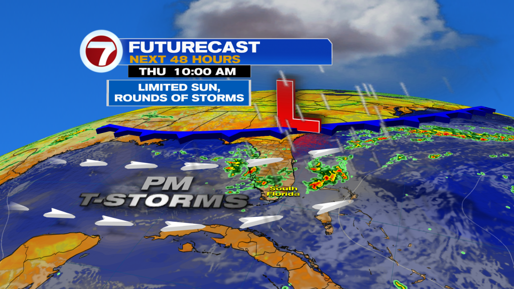
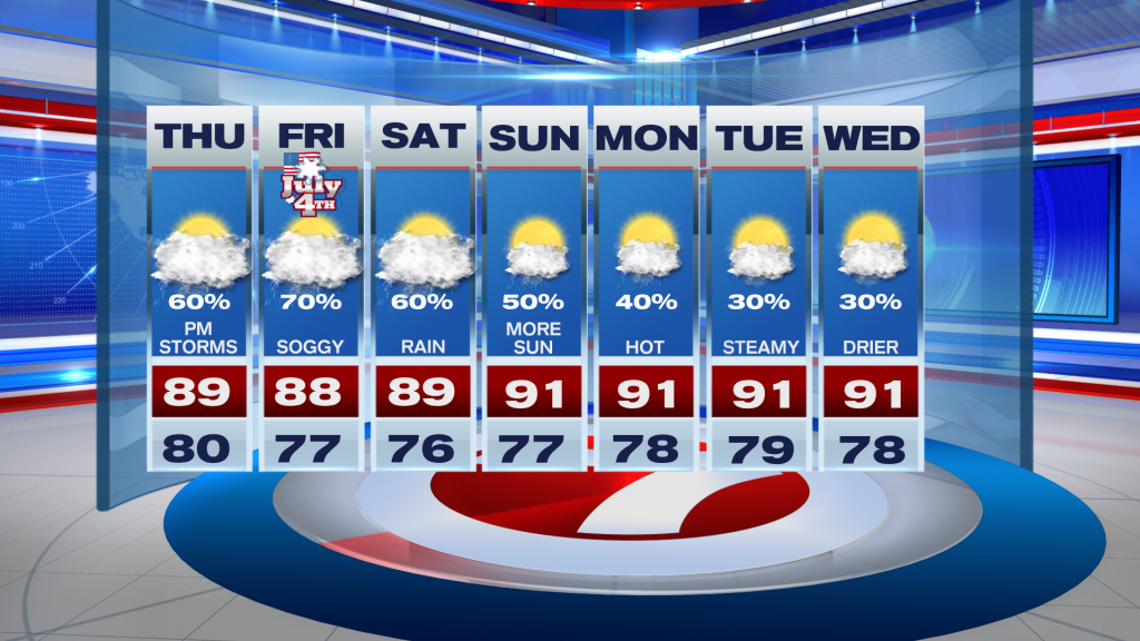
Today will likely bring more rounds of showers and thunderstorms across the area. We have a wind out of the South to Southwest, which continues to transport moisture in our direction and as showers and storms develop, our wind pattern will steer those showers and storms towards the East Coast. This will be the area where we can expect the best chance of seeing showers and thunderstorms this afternoon. Speaking of, afternoon high temperatures will reach into the upper 80s and some areas might even reach the low 90s with times of sunshine throughout the day.
Tomorrow is the 4th of July and if there was ever a holiday that we preferred to stay dry, it is this one. Unfortunately, fireworks may be at risk for some as showers and storms return to the forecast once again. With that said, the best chance of seeing rain will be during the afternoon so we might get lucky and see a break in the rain by the time fireworks begin! If you have any holiday outdoor plans during the day time hours, be sure to have a back up plan just in case you encounter a shower. Here’s hoping that if we are to see another stormy day, that most of it is done by the evening!

Looking ahead into the weekend, a front will be stalling somewhere across the state of Florida and an area of low pressure could spin up along that stalled front. The National Hurricane Center is watching this area closely as some tropical or subtropical development could be possible over the Atlantic between the coast of Florida and the Carolinas. That is, IF the low spins up any sort of tropical system. Regardless of development, this would pose no immediate concern to South Florida. Our holiday weekend forecast remains the same. Times of rain and thunderstorms with some slight improvement for the latter part of the weekend.
Have a safe holiday weekend!
Erika Delgado
Meteorologist
WSVN / Channel 7 News
Copyright 2025 Sunbeam Television Corp. All rights reserved. This material may not be published, broadcast, rewritten or redistributed.
(Except for the headline, this story has not been edited by PostX News and is published from a syndicated feed.)