
RADAR CHECK: Humid, unstable air covers Alabama today, allowing for scattered to numerous showers and storms across the Alabama landscape today. Though most activity at the writing of this forecast is isolated, the radar will become very active this afternoon once the convective temperatures is met. You’ll know when that happens because the radar will light up like a Christmas tree. Showers and storms are completely random in nature, but where they occur expects loads of lightning and tropical downpours. These tropical downpours can cause areas of isolated flash flooding. Though organized severe storms are not expected, an isolated severe storm or two is certainly possible any afternoon during the summertime due to the very high instability values. The main threats with stronger storms; gusty winds and hail.
Not much change through tomorrow, above average rain chances, with the greatest coverage occurring during the peak heating of the day; 1PM-10PM. Highs today and tomorrow will range from upper 80s to lower 90s. If you see a storm in your locations, it will knock those temperatures well down into the 70s.
BIRMINGHAM ALMANAC: For July 10th, the average high for Birmingham is 91° and the average low is 72°. The record high is 105° set in 1930, while the record low is 56° set in 1952. We average 0.18” of precipitation on this date and the record value is 3.01” set in 1979.
WEATHER RADAR MAINTENANCE: The National Weather Service radar in Tuskegee, AL (KMXX) is back online after routine maintenance. Tomorrow and Saturday the National Weather Service radar in Calera, AL (KBMX) will be offline for maintenance. It should return to service on the 12th. There are several surrounding radar sites available should active weather materialize.
ACROSS THE USA: Strong thunderstorms are forecast across parts of the Central Plains and Midwest today with damaging wind gusts, large hail, and heavy rainfall the primary threats. Heavy rain and scattered flash flooding is also possible across the Carolinas into Virginia. Elevated to critical fire weather concerns in the Four Corners region as Extreme Heat Warnings remain in effect across the Desert Southwest.
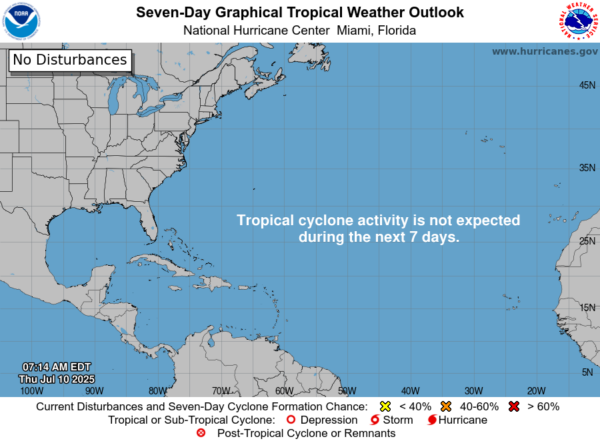
IN THE TROPICS: The Atlantic Basin is quiet, with no tropical cyclone development expected the next seven days this is according to the National Hurricane Center.
WEEKEND WEATHER: Rain chances will decrease some over the week as an upper-ridge tries to build in bring warmer air aloft. For both Saturday and Sunday, expect partly sunny days, highs in the upper 80s Saturday, and then low to mid 90s on Sunday.
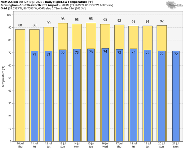
NEXT WEEK: It’s the “Dogs Days of Summer,” meaning a classic, summertime pattern will persist for much of next. Each a mix of sun and clouds each day, with random, scattered afternoon and evening storms, mainly during the 1pm-10pm timeframe. Rain chances will be in the 40-50% range for the first half, but look to increase above 60% to end the week.
WORLD TEMPERATURE EXTREMES: Over the last 24 hours, the highest observation outside the U.S. was 118.2F at Ejido Nuevo Lean, Mexico. The lowest observation was -111.1F at Vostok, Antarctica.
CONTIGUOUS TEMPERATURE EXTREMES: Over the last 24 hours, the highest observation was 123F at Death Valley, CA. The lowest observation was 32F at Austin, NV.
Category: Alabama’s Weather, ALL POSTS, Social Media
(Except for the headline, this story has not been edited by PostX News and is published from a syndicated feed.)